
Ymele:Lighthouse Malarrif at Snæfellsnes peninsula.jpg

Micelness þisre forebysene: 800 be 438 dotta. Oðra metinga brædo: 320 be 175 dotta | 640 be 351 dotta | 1,024 be 561 dotta | 1,280 be 701 dotta | 2,560 be 1,403 dotta | 7,959 be 4,361 dotta.
Frumlicu ymele (7,959 × 4,361 pixela, ymelan micelness: 21.04 MB, MIME cynn: image/jpeg)
Scortness
| Towritenness |
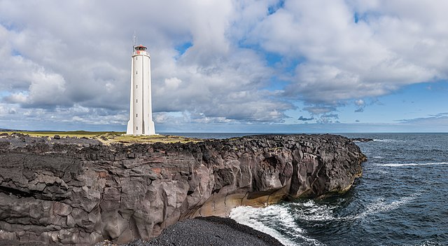
Deutsch: Leuchtturm Malarrif, Snæfellsnes, Island
English: Lighthouse Malarrif, Snæfellsnes, Iceland
Ślůnski: Morsko latarńijo, Snæfellsnes, Islandyjo. |
| Tælmearc | |
| Fruma | Agen weorc |
| Dædfruma | Richard Bartz |
| Leaf (Eftnytt þisse ymelan) |
This file is licensed under the Creative Commons Attribution-Share Alike 3.0 Unported license.
|
|
This image was selected as picture of the day on Wikimedia Commons for 8 September 2013. It was captioned as follows: English: Lighthouse Malarrif, Snæfellsnes, Iceland. Other languages:
English: Lighthouse Malarrif, Snæfellsnes, Iceland. 中文: 冰岛斯奈山半岛上的灯塔。 |
| Camera location | | View this and other nearby images on: OpenStreetMap |
|---|
This image has been assessed using the Quality image guidelines and is considered a Quality image.
|
Ymelan stær
Swing dæg/tide mid mys to seonne þa ymelan swa heo wæs on þære tide geywed.
| Dæg/Tid | Metungincel | Micelnesse gemetu | Brucend | Ymbspræc | |
|---|---|---|---|---|---|
| nu | 16:02, 30 Mædmonað 2013 | | 7,959 × 4,361 (21.04 MB) | Richard Bartz | Minor Fix. |
| 20:21, 28 Mædmonað 2013 |  | 8,000 × 4,361 (9.17 MB) | Richard Bartz | Fix. Wrong ICC Profile. | |
| 19:06, 28 Mædmonað 2013 |  | 8,000 × 4,361 (20.97 MB) | Richard Bartz | == {{int:filedesc}} == {{Information |Description= {{de|Leuchtturm Malarrif, Snæfellsnes, Island }} {{en|Lighthouse Malarrif, Snæfellsnes, Iceland}} |Source = {{Own}} |Date = 2013-07-14 |Author= Richard Bartz |Permission= {... |
Biliþbendas
Þǣr sind nāne trametas þe bindaþ tō þissum biliðe.